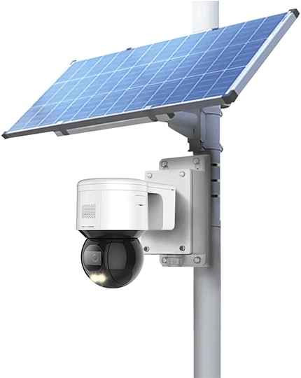
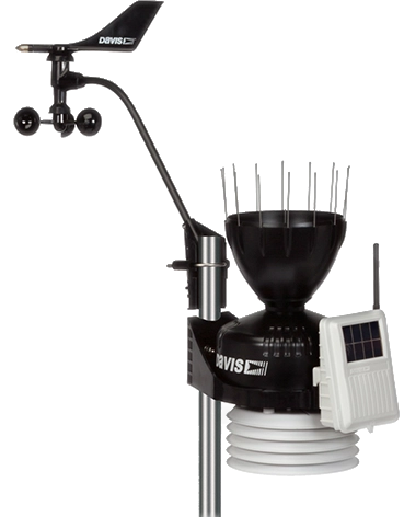
iDeria Smart River Monitoring System incorporates weather station, water level, water flow to allow highly accurate measurements while being a compact and quality reference system. The CCTV camera provides essential visual footage for advanced analytics and prediction through our state-of-the-art AI model. The unit is especially suitable for harsh or marine environments. More details
Contact Us
| Parameter | Value |
|---|---|
| Power Supply | DC 7V to 36V |
| Power Consumption | Peak Current: < 130mA |
| Working Temperature | -35°C to 75°C |
| Storage Temperature | -40°C to 80°C |
| Humidity | 95% RH |
| Speed range | 0.1m/s to 20m/s |
| Speed Resolution | 0.01m/s |
| Speed Accuracy | +/-0.01m/s |
| Radar Frequency | 24GHz |
| Angular Coverage | 30° to 60° |
| Angular Resolution | 0.1° |
| Angular Accuracy | +/-1° |
| Height Range | 0m to 30m |
| Range Accuracy | +/-2mm |
| Range Resolution | 1mm |
| Camera | |
|---|---|
| Image Sensor | 1/2.8" CMOS |
| Pixel | 4 MP |
| Max. Resolution | 2560(H) x 1440(V) |
| ROM | 4 GB |
| RAM | 1 GB |
| Electronic Shutter Speed | 1/1 s - 1/30,000 s |
| Scanning System | Progressive |
| Min. illumination | Color: 0.005 lux@F1.6 B/W: 0.0005 lux@F1.6 0 lux (IR light on) |
| Illumination Distance | 150 m (492.13 ft) (IR) 80 m (262.47 ft) (white light) |
| Illuminator Number | 4 (IR) 2 (white light) |
| PTZ | |
| Pan/Tilt Range | Pan: 0° to 360° endless Tilt: -20° to +90°, auto flip 180° |
| Manual Control Speed | Pan: 0.1° - 160°/s endless Tilt: 0.1° to 120°/s |
| Preset Speed | Pan: 240°/s Tilt: 150° |
| Preset | 300 |
| Tour | 8 (up to 32 presets per tour) |
| Pattern | 5 |
| Scan | 5 |
| Power-off Memory | Yes |
| Idle Motion | Preset; Pattern; Tour; Scan |
| Parameter | Value |
|---|---|
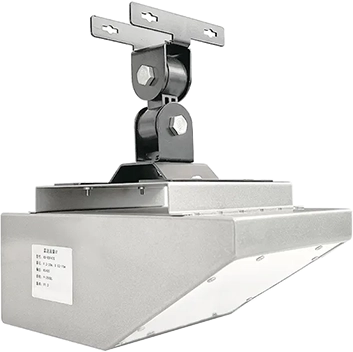
| Supply Voltage | 8-17V 12V (recommended) |
| Power Consumption | 100 mA @ 12V supply |
| Power Supply Mode | 240V AC |
| Rated Working Temperature | -40°C to +70°C |
| Rated Storage Temperature | -40°C to +80°C |
| Rated Humidity | 0 to 100% RH |
| Dimensions | 164 (diam.) x 473 (H) mm |
| Weight | 1850 g |
| Protection Level | IP65 |
| Parameter | Range | Sensitivity | Accuracy | Unit |
|---|---|---|---|---|
| Wind Speed | 0 - 70 | 0.1 | +/-0.3 | m/s |
| Wind Direction | 0 - 359 | 2 | +/-2 | ° |
| Ambient Humidity | -40 - +120 | 0.1 | +/-2 | °C |
| Ambient Humidity | 0 - 100 | 0.1 | +/-0.2 | % RH |
| Rainfall | 0 - 1000 (hourly) | 0.2 | +/-0.2 | mm |
| PM2.5 | 0 - 25 | 0.1 | +/-0.2 | µg/m3 |
| PM10 | 0 - 25 | 0.1 | +/-0.2 | µg/m3 |